LOCATION: (lat. 28°32'46.7" N., long. 82°37'09.0" W.)
Little Salt Spring is located West of US 19 on SR 50, 2/10 mi. past the intersection of Shoal Line Blvd. A path on the South side of SR 50 leads through a break in the fence to the spring and its run.
DESCRIPTION:
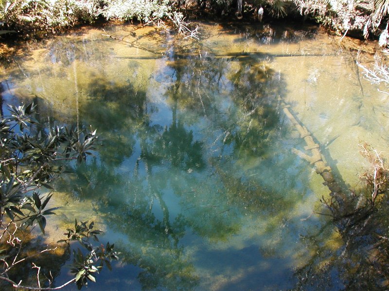
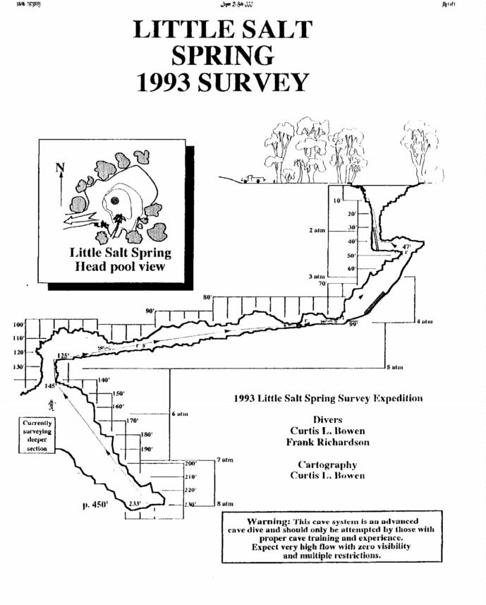
This site has also been known as Salt Spring, but in reality, it should be "springs", as there are actually two spring vents. One is a solution tube in the middle of the basin, the other a small hole in the Northwest side of the basin that constantly spews the type of reddish particles found at nearby Mud Spring. As its name implies the water flowing from both spring's is fairly salty. For decades the spring was used extensivly for swimming, partying and diving but it is now fenced and the only legal access is with permission of the owner or by canoe or kayak from the river. The extreme depth and strong flow of this system may have led to some cave diving deaths back in the 60's or 70's but I have not been able to confirm any of the stories. Divers exiting the cave can be pushed so hard that they lose control and tumble. (and possibly knocked out). I've personally seen people get wedged in the first restriction to the point of needing assistance. I've also had my mask ripped off by the flow in one particularly strong section of the cave. This is can be a great dive for those in excellent physical condition.
DIVELOG:
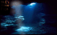
Entering the basin we dropped down to 20ft and made our way to a perfectly round solution tube around 8ft in diameter. The tube, which has a palm tree wedged upright in the middle, descends 60ft to a short side passage that leads to a vertical restriction in the floor and the beginning of the permanent guideline. A strong flow can be expected here so we deflated our BC's and pulled our way down, around and through a couple more restrictions to a depth of 125ft. The flow was incredible, but there were plenty of handholds and a couple of dead spots to stop and rest. Continuing on, we soon came to a crack in the floor and the line took a 90 degree turn straight down. Lowering ourselves into the crack, the flow subsided as the walls gave away to a massive domed room with a steeply sloping floor. Visibility was around 30 to 40ft but the room was so big our lights revealed nothing more than the sloping wall closest to the line. We followed the line to the bottom at 238ft where the wall undercut sharply. A halocline blurs ones vision at this depth, but if you keep your wits and navigate around some of the breakdown you will find the partially blocked the vent responsible for this caves enormous flow. I lowered my primary light head down between the rocks and fantasized about what was on the other side a bit, then we made our way back up into the flow for a free ride to the surface. Deco time was spent teasing fish and watching mini avalanches as sand and debris continullay slide into the shaft only to be blown back out to the edges for another cycle.
